find us on facebook

Welcome. .

selamat datang di blog saya, semoga bermanfaat :)

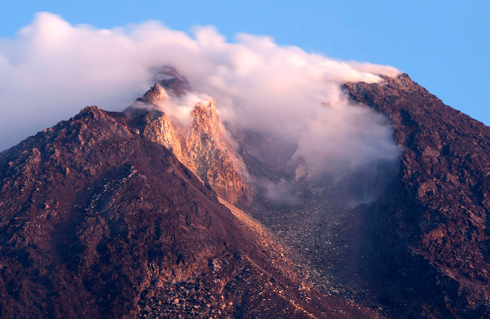
mount merapi is very dazzle

click this picture for more read

Kraton Yogyakarta

more information click here

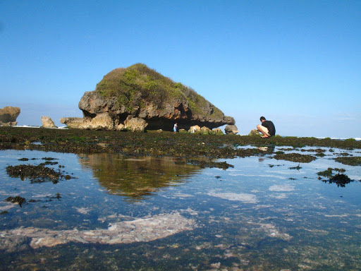
sadranan beach very beautiful beach

click this picture for more information

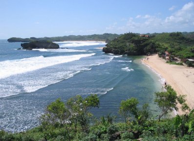
siung beach with white sand

siung is very beautiful, click this picture for read siung beach

parangtritis with high waves

click here for more read

Showing posts with label tour guide. Show all posts

Friday, November 18, 2011

Prambanan beautiful temple in Indonesia


Prambanan is incredibly beautiful building built in the 10th century during the reign of two kings, Rakai Rakai Pikatan and Balitung. Rose as high as 47 feet (5 meters higher than Borobudur temple), the foundation of this temple has fulfilled the desire to show Hindu triumph in Java Island. This temple is located 17 kilometers from the city center, in the middle of the area that is now a beautiful park.


There is a legend that Javanese people always tell about this temple. Once, a man named Roro Jonggrang Bondowoso love. Because of his love, Jonggrang asked Bondowoso make 1000 temples with statues in one night. The request was nearly fulfilled Jonggrang asked the villagers to pound rice and make a big fire that created an atmosphere like the morning. Bondowoso who only completed 999 statues cursed into a statue to Jonggrang-1000 because he felt cheated.


Prambanan temple has three main temples in the primary yard, namely Vishnu, Brahma, and Shiva. These three temples are symbols of Trimurti in Hindu belief. The third temple is facing east. Each main temple has accompanying temple facing to the west, namely Nandini for Shiva, Swan to Brahma, and Garuda for Vishnu. In addition, there are two temples wedge, 4 temples color, and 4 corner temples. In the second had 224 temples.


Entering Shiva temple located in the middle and the highest building, you will find a room 4. One main room with a statue of Shiva, while the other 3 chambers each containing a statue of Durga (Shiva's wife), Agastya (Shiva's teacher), and Ganesha (the son of Shiva). Durga is mentioned as a statue of Roro Jonggrang described in the legend above.


In the Vishnu temple is located in the north of the temple of Shiva, you will only find one room with a statue of Vishnu. Brahma temple, which lies south of Shiva temple, you will only find one room with a statue of Brahma.


Quite attractive accompanying temple is Garuda temple located near the Vishnu temple. This temple keeps a story of half-bird called Garuda. Garuda is a mythical bird in Hindu mythology who was gold, white face, red wings, beak and wings like eagles. Estimated, figure is Hindu adaptation of Bennu figure (meaning 'sunrise' or 'shining', associated with the god Re) in ancient Egyptian mythology or Phoenix in Greek mythology. Garuda succeeded in saving his mother from the curse of Aruna (Garuda's brother who was born handicapped) by stealing Tirta Amrita (holy water of the gods).


Ability to save that which is admired by many people until now and are used for various purposes. Indonesia uses the symbol of the state. That said, the emblem of Garuda Pancasila creator for inspiration in this temple. Other countries also use it to sign the country is Thailand, with the same reason but different form adaptation and appearance. In Thailand, Garuda is known as Krut or Pha Krut.


Prambanan also has panels of relief describing the story of Ramayana. According to experts, the relief is similar to the Ramayana story is revealed through oral tradition. Another interesting relief is Kalpataru tree that the Hindu religion is considered as a tree of life, sustainability and environmental compatibility. At the Prambanan reliefs depicted Kalpataru trees flanking the lion. The existence of this tree makes experts consider that the people of the 9th century had wisdom to manage its environment.


Just like the figure of Garuda, Kalpataru is now also used for various purposes. In Indonesia, Kalpataru became a symbol of Environment (Walhi). In fact, some scientists in Bali to develop the concept of Tri Hita Karana for environmental conservation by seeing Kalpataru relief in this temple. Tree of life can also be found in the mountains that used to open the puppet arts. A proof that the relief panels in Prambanan has worldwide.


If careful, you can also see various birds relief, this time a real bird. Bird reliefs at Prambanan are so natural that biologists can identify to genus level. One was relief of Yellow-crested Cockatoo (Cacatua sulphurea) that invites questions. Why, the bird was actually just there Masakambing Island, an island in the Java Sea. Then, whether the type that was once widely available in Yogyakarta? Please find out yourself. Because, until now no single person who could solve the mystery.


Well, there are many more that can be extracted at Prambanan. You certainly should not be bored. If it was finally exhausted, you can relax in the garden around the temple. Interested? Come immediately. Since September 18, 2006, you can enter a zone of Prambanan, although not yet able to enter the temple. Some of the damage caused by the earthquake last May 27, 2006 are now being repaired.


Script: Yunanto Wiji Utomo
read in Indonesian
Wednesday, November 16, 2011

Borobudur temple in Indonesia


Borobudur temple is located in Magelang, Central Java, about 40 km from Yogyakarta. Borobudur has 10 levels consisting of 6 levels of a square, 3 levels of circular and a main stupa as a peak. At every level there are several stupas. Altogether there are 72 stupas in addition to the main stupa. In every stupa there is a statue of Buddha. Ten levels of Buddhist philosophy the ten levels of Bodhisattva who must pass to reach the perfection of the Buddha in nirvana. Perfection is denoted by the main stupa at the top level. Borobudur structure when viewed from above form a mandala structure that describes the Buddhist cosmology and human thinking.

On the fourth side of the temple there is the gate and stairs to the level above it like a pyramid. This illustrates the Buddhist philosophy that all life came from rocks. Stone later became the sand, then a plant, then the insects, then become a wild animal and pets, and finally became a man. This process is known as reincarnation. The last process is to be the soul and finally into nirvana. Each stage in the process of enlightenment is based on the Buddhist philosophy of life depicted in the reliefs and sculptures in the temple of Borobudur.

This huge building just a giant pile of stone blocks which have a total height of 42 meters. Each stone spliced ​​without using cement or adhesive. These stones are simply spliced ​​based on the pattern and stacked. The base of Borobudur temple is about 118 m on each side. The stones used approximately 55,000 cubic meters. All the stones were taken from the river around the Borobudur Temple. These stones are cut and then transported and connected with a pattern like a lego game. All without using glue or cement.

While the relief began to be made after the stones are stacked and jointed finish. Reliefs found on the temple walls. Borobudur has 2670 different relief. Relief is read clockwise. This relief illustrates a story that I read it starts and ends at the gate to the east. This suggests that the main gate facing east Borobudur like most other Buddhist temples.

Kintamani, Bali, Indonesia very nice place


Kintamani, which is located in Bangli district, is one of the favorite tourist attractions tourist options both domestically and abroad.

Generally in almost any travel agent or tour operator in Bali, Kintamani entry in the itinerary (travel route) after visiting the Moon Stone (Barong Dance), the tourist area of ​​Ubud or Sukawati as a shopping center.

Kintamani offers a fresh atmosphere of the hills with temperatures around 18 degrees Celsius, much like the air in Bedugul. The main attraction of the region is a view of Mount Kintamani and Lake Batur. Mount Batur is a mountain that is still active status and the second highest after Mount Agung at Besakih. The best atmosphere is when enjoy lunch while enjoying the beauty of lake and mountain belching smoke friendly.

Interested in knowing more about Kintamani? Also a time to yourself to visit the village Trunyan located near the lake. But you have to cross by boat to get there by traveling approximately 20 minutes. The interesting and unique is the way the funeral locals certainly different from the prevalence in Bali. The bodies were buried without leaning against the tree. But the issue is not unique body odor because neutralized by the smell of fragrant wood called incense.

how? Interesting is not it? so welcome to Indonesia in Bali in particular, and enjoy your vacation.
kenyit

Monday, November 14, 2011

sundak enchanting beach hearts


The beach is located in the village Sundak Sidoharjo, District Tepus, Gunungkidul District, Yogyakarta Special Province (DIY). Sundak Beach at the easternmost end of a row of beaches Baron, Krakal, Kukup. This beach is relatively natural, beautiful with the dominance of blue sea and white sand beaches. Coast Sundak very interesting places to visit in the morning or late afternoon. Sunset and sunrise in this beach does offer spectacular natural scenery. The beach is relatively quiet this will probably offer something that appeals to you who desire a peace. Sundak not as famous beach beach baron, but for people who want to find the tranquility of the beach Sundak is the right choice. Sheets of white sand stretching along the shore, waiting for the whisper of waves hit, as if to give comfort and tranquility for those who desire it.

The tourists
will be pampered with a beauty of the wind waves which deliver tuk making out with sand, so patiently waiting for her lover. The results of Baron wealth as large shrimp (lobster), white pomfret fish, snapper, tuna are ready to pamper guests, both of which are still fresh and ready to eat. As a Recommendation, the menu mainstay here is Sop Kakap.

Sundak name name is a blend between ASU and the porcupine. Starting from the fight between ASU (dog) and porcupine. Pergelutan who left a trail for residents about the existence of a cave with a source of fresh water in it.

One moment is shockingly not miss the Sea Alms Ceremony organized by the local fishing community in the calendar each month suro Java, as an expression of gratitude to Almighty God for an abundance of seafood that has been given.

mount merapi tour


Mount Merapi is the youngest mountain in the volcanic sequence that leads to the south of Mount Ungaran. The mountain is formed by the subduction zone of activity in the Indo-Australian Plate is moving under the Eurasian Plate to cause the appearance of volcanic activity along the central part of Java Island. The peak is now overgrown with vegetation is not because of high volcanic activity. This peak grows in the southwest side of the peak of Mount Batulawang older.

The process of formation of Mount Merapi has been studied and published since 1989 and so on. Berthomier, a French scholar, divided into four stages of development of Merapi. The first stage is the Pre-Merapi (up to 400,000 years ago), namely the Mountain Aunt parts can still be seen on the east side of the peak of Merapi. Stage occurs when the Old Merapi Merapi began to take shape but not conical (60000-8000 years ago). The remains of this phase is Turgo Hill and Hill Plawangan in the south, which is formed of basaltic lava. Next is the Middle Merapi (8000 - 2000 years ago), characterized by the formation of high peaks, like Mount Gajahmungkur and Batulawang, which is composed of andesite lava. During the formation process is characterized by lava flows, brecciation of lava and hot clouds. Activities are effusive eruptions of Merapi has (melt) and explosive. It is estimated that explosive eruptions also occurred with the collapse of material toward the west that left the horseshoe morphology with a length 7 km, a width of 1-2 km with a few hills on the western slope. Pasarbubar crater (or Pasarbubrah) predicted to form at this time. Merapi peak current, peak Anyar, just beginning to form around 2000 years ago. During its development, is known to occur several times an explosive eruption with VEI 4 based on observations tefra layer.

Characteristics of eruption since 1953 is the insistence of lava into the summit crater is accompanied by periodic lava dome collapse and pyroclastic formation (nuee ardente) which can slide on the slopes or vertically upward. The eruption of Merapi type is generally not a sound but the hiss of the explosion. Dome top which existed until 2010 was the result of ongoing process since the eruption of gas in 1969.

Geologists in 2006 detected a giant space beneath Merapi containing materials such as mud that is "significantly impede the vibration wave earthquake". Scientists estimate that the material is magma. The bags are part of the magma that formed due to the formation of the Indo-Australian Plate menghunjamnya under the Eurasian Plate .
The peak of Merapi in 1930.

Small eruptions occur every 2-3 years, and the larger about 10-15 years. Merapi eruptions recorded a big impact in the year 1006 (allegations), 1786, 1822, 1872, and 1930. The eruption in the year 1006 makes the whole enveloped in the central part of Java Island ash, based on observations of volcanic ash deposits. Dutch geologist van Bemmelen, theorizes that the eruption caused the center of the Kingdom of Medang (Mataram) should be moved to East Java. The eruption in 1872 is considered as the strongest eruption in modern geological record with VEI scale reaches 3 to 4. Recent eruption, in 2010, is expected also to have power close to or equal. The eruption of 1930, which destroyed thirteen villages and killed 1400 people, is the biggest victims of the eruption with a record until now.

November 1994 eruption caused the hot clouds glide down until reaching some villages and claimed 60 human lives. July 19, 1998 eruption is quite large but pointing upwards so that no casualties. Note the last volcanic eruption was in 2001-2003 in the form of high activity are ongoing. In 2006 Mount Merapi high-return activities and had swallowed two lives Kaliadem volunteers in the region due to hit the brunt of the hot cloud. The series of eruptions in October and November 2010 were evaluated as the largest since the eruption in 1872 and claimed the lives of 273 people (as of 17 November 2010) , although it has imposed intensive observation and preparation for evacuation management. The eruption of 2010 also observed as a deviation from the eruption "Merapi type" because it is accompanied by explosive sounds and thunderous explosions that sounded up to a distance of 20-30 km.

The volcano is monitored non-stop by the Center for Observation of Mount Merapi in Yogyakarta, assisted by various geophysical instruments telemetry around the mountaintop observation posts and a number of visual and seismic recorder in Ngepos (Srumbung), Babadan, and Ground.

Eruption 2006

In April and May 2006, began to appear signs that Merapi will erupt again, is characterized by earthquakes and deformation. The local government of Central Java and Yogyakarta have prepared evacuation efforts. Instructions also have been issued by both local governments so that residents living near Merapi immediately flee to places that have been provided.

On May 15, 2006 finally Merapi erupted. Then on June 4, it was reported that the volcanic activity has exceeded the alert status. Head of the Special Region of Yogyakarta BPPTK, Ratdomo Purbo explained that approximately 2 to 4 June the volume of the lava dome of Merapi has reached 4 million cubic meters - meaning that the lava has filled the whole capacity of the dome of Merapi lava bursts so that the latest addition will go right out of the dome of Merapi.

June 1st, rain of volcanic ash from Mount Merapi, hot clouds glide dense, three days later this happened and in Magelang Magelang regency, Central Java. Muntilan about 14 kilometers from the summit of Merapi, most felt this ash.

June 8, Mount Merapi erupted at 9:03 pm with a blast of hot clouds that made thousands of residents in the area of ​​the slopes of Mount Merapi panicked and attempted to flee to safety. Today recorded two eruptions of Merapi, a second eruption occurred at around 09:40 pm. A burst of hot clouds as far as 5 km further leads to the upper Kali Gendol (southern slopes) and destroyed most forests in the north Kaliadem in Sleman region.
[Edit] Eruption 2010
Main article for this section are: Eruption of Mount Merapi 2010

Increasing the status of "normal active" to "alert" on September 20, 2010 recommended by the Center for Investigation and Technological Development Kegunungapian (BPPTK) Yogyakarta. After about a month, on October 21, status changed to "idle" since at 18:00 pm. At this level of displacement activities have to be prepared. Because of increasing activity, indicated by a high frequency multiphase earthquakes and volcanic earthquakes, since 06.00 am October 25 BPPTK Yogyakarta tangggal recommends increasing the status of Mount Merapi to "alert" and all the inhabitants of the area within a radius of 10 km from the summit should be evacuated and evacuated to the region is safe.

The first eruption occurred at around 17:02 pm on 26 October. Occur until at least three times the eruption. Volcanic eruptions eject material as high as approximately 1.5 miles and accompanied the release of heat clouds which swept Kaliadem, Kepuharjo Village, District Cangkringan, Sleman. and killed 43 people, plus a baby from Magelang who died because of respiratory disorders.

Since then regurgitated hot clouds started happening on an irregular basis. Starting October 28, Mount Merapi spewed lava that appeared almost simultaneously with the discharge of hot clouds at 19:54 pm. Next start hotspots observed silence at the top on November 1, marking a new phase that the magma has reached the pit crater.

However, different from the character of Merapi typically, rather than the formation of a new lava dome, which in fact happened was increased activity bursts of lava and hot clouds since November 3. Explosive eruption of a major eruption began on the morning of Thursday, November 4, 2010, resulting in cloud fields as high as 4 km and bursts of hot clouds in different directions at the foot of Merapi. Furthermore, since about three o'clock in the afternoon eruption that will not cease until the evening and reached its peak in the early hours of Friday, November 5, 2010. Toward midnight, the radius of danger to all the places enlarged to 20 km from the summit. This series of eruptions and rumbling sounds to the city of Yogyakarta (distance about 27 km from the summit), Magelang and Wonosobo district center (distance 50 km). The rain of gravel and sand reach the northern city of Yogyakarta, while the thick rain of volcanic ash up Navan and Cilacap struck. In the afternoon, volcanic ash is known to have reached Tasikmalaya, Bandung, and Bogor.

Secondary hazards of cold lava flow also threatens the region lower on 4 November after heavy rains occur around the peak of Merapi. On November 5 of the Code in the region of Yogyakarta declared status "alert" (red alert).

Strong eruption 5 November followed by a high activity for about a week, before then there was a slight decrease in activity, but the security status remains "Caution". On 15 November 2010 to limit the danger radius of Magelang regency reduced to 15 km and for two other districts of Central Java to 10 km. Just for the District. Sleman that still remain in place 20 km radius of danger.

Kraton Yogyakarta in Yogyakarta Indonesia


KRATON - Palace of the King of Yogyakarta

Stretching between the monument as the northern boundary and stage boundaries Krapyak in the south, between Code River in the east and west Winongo River. Between Mount Merapi and the South Seas, the Palace in the minds of the Java community, defined as the center of the world which is described as the center of the universe.

After the Treaty Giyanti, Prince Mangkubumi given region of Yogyakarta. To run the rule, Prince Mangkubumi build a palace in 1755 in Beringan Forest region. This land is considered quite good because it is sandwiched between two rivers that protect it from possible flooding. The first king in the Sultanate of Yogyakarta is the title of Prince Mangkubumi lane I (HB I).
Naming and Meaning Layout

Palace, Palace or Palace, is derived from ka-queen's, which means a place to live the queen / king. Being a broader sense, described simply, that all structures and buildings in the Kraton area have significant meaning related to essential Javanese philosophy of life, namely Sangkan Paraning dumadi (where it comes from humans and where eventually humans after death).

Outline, the Kraton area extending 5 km to the south until Krapyak and 2 km to the north end of the monument. On this line there is a dualism linear line upside down, so it could be read symbolically philosophical. From south to north, as the birth of human beings from on high to the mortal nature, and vice versa as the return of humans to the side dumadi (God in view of Java). While the physical with the king's palace as a symbol of the true soul that comes into the physical body.

Palace to Monument also be interpreted as a way of life that is full of temptations. Beringharjo market symbolizes women temptation. While the temptation for power is symbolized by House Kepatihan. Both are located on the right. Straight road itself as a symbol of man who is close to the Creator (Paraning impressive dumadi).

Simply put, monument symbolism Linga (male) and Krapyak as Yoni (female). And Kraton as body derived from both.
Spatial meaning of Kraton

Hit by the earthquake in 1867, the Palace was severely damaged. At the time of HB VII in 1889, the building was refurbished. The lay still retained, but modified form of the building as it looks now

Monument and the Ward or Wards Manguntur Tangkil Kencana (where the king's throne), located in a straight line, this means, when the Sultan sat on his throne and looking toward the monument, then he will always remember his subjects (subjects manunggaling gusti).

Kraton same order of Mataram Dynasty in general. Kencana ward who became the king's reign, together with Prabayeksa as a place to store weapons Kraton heritage (in this room there Wiji Kyai oil lamp, which has always maintained that the courtiers are not extinguished), serves as the center. The ward is covered by the court Kedhaton, so as to reach the center, pass through a page that resembles a series of layered bewa (waves) over the ocean.

Arrangement of the Palace is very similar to the constellation of mountains and plains Dwipa Guava, which is seen as a continent of its center of the universe.

From north to south of the palace there are successive North Square, North Siti Hinggil, North Kemandhungan, Srimanganti, Kedhaton, Kemagangan, South Kemandhungan, Siti Hinggil Square South and South (the sheltered courtyard wall height).

While the door to go through to get to each place of nine, called Regol. From the north there is a gate, pangurukan, Tarub great, brajanala, srimanganti, kemagangan, Gadhung Mlati, kemandhungan and ivory.

Brongtodiningrat critical look at these numbers, the highest number that describes perfection. This corresponds to nine holes in man, commonly called air babahan sanga.

The sacredness of each Palace building is indicated by the frequency and intensity of Sultan activities in place.

Square, Pagelaran, and Siti Hinggil, at this place the Sultan only present three times a year, namely during the events of Pisowan Ageng Grebeg Maulud, Sawal and Besar. As well as a very incidental occasion a very special example at the time of the coronation of the Emperor and Crown Prince or Princess Coronation Duke Anom.

Kraton is indeed an old building, once damaged and restored. At first glance like other Kingdom buildings. But if we explore the Sultan's Palace, which is the largest and most beautiful examples with symbolic meaning, a philosophy of life, human nature, how nature works and human beings live their lives and various symbols of life existence in it. (YogYES.COM)

Authors: R. Shah
Photo & Artistic: Sutrisno
Copyright © 2006 YogYES.COM

sadranan beach yogyakarta Indonesia very charming


"Want to coastal tourism in Yogyakarta, go to Parang Tritis!"

Perhaps these words we often hear when visiting the province of Yogyakarta. The most famous beach resort of Parang Beach Tritis indeed, has a mileage of around 45 minutes drive from the city of Yogyakarta. Though there are many beaches in this province is better than Parang Tritis Coast. One of them is the beach that I visited, that is Beach Sadranan.

Sadranan is offered by the exotic beaches of South Mountain. District is located in the eastern part of DIY is indeed famous for its white sand beaches that are not less interesting than similar beaches in Bali. Call it a beach Krakal, Kukup, Baron, Sundak, and of course Sadranan. Sadranan beaches comes from the word seduluran / brotherhood and a Javanese traditional ceremony is usually done in the month Shaban. So the beach is crowded in to perform ceremony Sadranan Shaban.

Sadranan beach is located approximately 0.5 miles on the East Coast Krakal. If taken from Yogyakarta, will take about 2 hours. Still rarely public transport to get there, so it is advisable to use a personal vehicle. I myself was using a bike with my friend.

After leaving Yogyakarta, we will be treated fairly winding roads sharp, so be careful. But, after about 30 miles to take a winding road, the road becomes tend to be flat. To enter the beach area only charged for levy of Rp3.000, -. Sadranan beach is also somewhat hidden, we must pass through a narrow rocky road ahead to reach the shore. So is the beach signage locations are very small, so it should be fine pairs of eyes in order not to miss.

One of the privileges of this Sadranan beach is white sand whiter and cleaner than other beaches in the vicinity. Perhaps because this beach is not visited by many people. And, like several other beaches in the area Gunungkidul, Sadranan Coast there are also rocks that made waves on the beach is quite calm.

Near the beach there is also a stall. In the stalls in addition to providing food and beverages are the bathroom to wash up after a swim at the beach. Stalls are commonly used as a place to relax. Very convenient to use as a gathering place with friends while enjoying the ocean view.

siung beach Yogyakarta Indonesia very beautiful


Siung coast, has 250 points Climbing

Siung Beach is located in a remote area in Gunung Kidul, exactly Tepus south district. The distance is about 70 km from the city center, or about 2 hours drive. Reaching the beach is a motorcycle or a car of choice of many people, because it's hard to find public transportation. Colt or bus from the city Wonosari usually only up to the region Tepus, and even then had to wait for hours.

Stamina and a good vehicle performance is the primary capital to be able to reach this beach. Understandably, many challenges that must be conquered, from the slopes, sharp turns are sometimes accompanied by derivatives up to the heat that hit the skin when the road is surrounded by limestone hills and fields of crops. Everything is blocked since the Pathuk (first district in Gunungkidul encountered) to the beach.

As if there was no option to run from the challenge. Path Yogyakarta - Wonosari continued into the Gaza Wonosari - Baron - Tepus is the most accessible path, the path has been paved smooth and perfect. Another pathway through Yogyakarta - Imogiri - Gunungkidul have a formidable challenge because many roads are hollow, while the pathway Wonogiri - Gunungkidul if taken too far from the city of Yogyakarta.

Like the saying, "no pain to have fun then," as would a trip to Beach Siung. Pleasure, relief and peace can only be felt when it has reached the shore. Blue ocean and white sand, clean body will treat the lelah.Tersedia number of wooden houses on the beach, a place to lean back and chat with friends while enjoying the beautiful scenery.

One charm that stands out from the stone reefs Siung. Coral reefs are huge on the west and the east coast has an important role, not to add the beauty and the barrier to the other shore. Coral is also the basis of naming the beach, witness the triumph of the coastal areas in the past and the charm that makes this beach is increasingly recognized, at least in Asia.

Rock on which the naming of the beach is located slightly overhanging the ocean. The name is taken from the coastal rocks which form Wastoyo, a local elder, resemble an ape or Siung Vanara teeth. Until now, this rock can enjoy the beauty, combined with large waves that sometimes hit him, until the cracks laced by seawater that flows slowly, presenting a dramatic scene.

Ape tartar which is still resistant to scour the ocean waves is also to witness the triumph of Siung region in the past. According to the story Wastoyo, Siung region at the time the trustee becomes a center of trade in the region of South Mountain. Not far from the beach, in Winangun area, there is a market. In this place also, silent and Nyai Nyai We Podi, wife of servants in the palace of Yogyakarta and Surakarta.

Most of the residents Siung then living as peasants salt. They rely on sea water and the wealth of its salts as a source of livelihood. The salt produced by this Siung citizen who was a major commodity in the market Winangun. Although rich in various kinds of fish, not many people who dare to go to sea at the time. Generally, they are just looking for fish in shallow waters.

The situation gradually deserted when Winangun market, according to the narrative Wastoyo, brought to Yogyakarta. The market moved from Winangun is said in Yogyakarta named Jowinangun, stands outside the Jobo Winangun Winganun region. Local residents have lost their livelihoods, and not many more people who come to this area. No telling what local people did to survive.

Amid the quiet that the beauty of beach rock Siung back into play. Around 1989, a group of nature lovers from Japan utilized the coral cliffs located on the west coast as an arena rock climbing. Then, in the decade of the 90s, was a competition of Asian Climbing Gathering utilizing the coral cliff Siung Beach. Since then, the popularity Siung began to recover again.

Now, as much as 250 climbing routes available in Siung, facilitating rock climbing sports fans. Pathway is likely to still be added, the rule to be that the existing route with consent from the maker of the previous path. Many groups have made use of the climbing routes on this beach, like a group of students from the State University of Yogyakarta that was about to climb when YogYES visit this beach.

Other facilities also support the activities of rock climbing is a camping ground on the east coast. In the camping ground, the tents can be erected and fire can be set to spend the night. Terms of use just one, does not damage the environment and disturbing the turtle habitat, such as the sign board warning contained in the camping ground which can also be used for those who just want to spend the night.

Not far from the camping ground, a wooden house on stilts that can be used as a base camp, a choice but to set up a tent. The size of the base camp large enough, enough for 10-15 people. The stage-house to make the eyes more freely enjoy keeksotikan beach. Simply by talking to local residents, possibly with some amount of this base camp can be used for overnight.

At night or when there are visitors, long-tailed monkeys will fall from the cliff to the beach. Long-tailed macaques are now increasingly rare there's also at this beach. The existence of long-tailed macaques may also be one reason why the rock on which the naming shapes paired with monkey teeth, not the other animal species.

Wastoyo revealed, according to the narrative of the winasih (people who can read the future), will Siung rejomulyo or glory back in time soon. Increasing number of visitors and popularity as an arena rock climbing to be one sign that this beach to its former glory. Tourist visits, including you, will surely accelerate the coming to the triumph.

Script: Yunanto Wiji Utomo

Twitter Delicious Facebook Digg Stumbleupon Favorites More